The Study Area
Drowned Cayes, Belize
Katie and Caryn's manatee study area is the Drowned Cayes (pronounced "keys")
off the coast of Belize. The Drowned Cayes 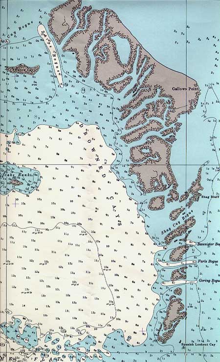 are
a string of mangrove islands about 13 km long, between Belize City and the
Barrier Reef. They are located about 8 km east of Belize City and less than
2 km west of the Barrier Reef. Click on the map for a larger image.
are
a string of mangrove islands about 13 km long, between Belize City and the
Barrier Reef. They are located about 8 km east of Belize City and less than
2 km west of the Barrier Reef. Click on the map for a larger image.
The Drowned Cayes got their name because the islands are mostly
made up of red mangroves, supported by their big red prop roots, which are
"drowned" in seawater at high tide. There is almost no true ground.
As the mangrove roots slow down the flow of seawater, sediment and organic
matter settles among the roots creating a marshy and wet substrate
known as peat.
The Drowned Cayes were chosen as the study site for three reasons:
When compared to other places (such as Florida), there isn't much disturbance
from human activities, yet. For example, there is no commercial swimming
with manatees allowed in Belize. This enables Katie and Caryn to observe
the manatees in their natural habitats and undisturbed by people.